
One of the places that intrigued me was Antelope Island. A large island situated in the Great Salt Lake and connected to the mainland by a 7-mile causeway, it drew my attention immediately.

Although it is a good 35 mile drive away (even though the southernmost tip is just a few miles away for Salt Lake city proper and connected by a sometimes submerged sometimes not causeway through some mudflats) I decided one afternoon to make the trip up from SLC to the island itself.
I should have checked the website because as I got there I realized it cost $9 to enter the island ($3 if you are on foot or bicycle; this shocked me since it is a SEVEN MILE run simply to get to the island but I digress). In the waning sun I decided I would save the island for another day.
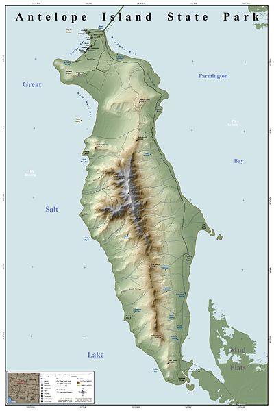
Well another day arrived. A good friend and I decided we would go for a run on this island this past weekend. I thought running on the island would be a great way to check out its splendor and get a tough run in as well. I knew that there were a few races on the island (including a 12k I may or may not do here in a few weeks) so I should be able to find some running trails. Luckily I did and we had our route mapped out.
Following a 25k race course we decided we would start around halfway between the mile one mark near the mile one trailhead. We would then follow it up until nearly the mile 4 markers before turning left and following the trail all the way around the hills until we completed a full loop. Give or take a jaunt would be a 7 mile run (see below).

Normally I would not care how beautiful a run would be, I won't drive 70 miles roundtrip to do it. but I knew this run would be worth it. Besides the discovery of a new island, we would be giving ourselves quite a workout. Below is the elevation profile of the entire looped course.

But if you take out the part we were going to skip, it would look like this.

So we knew we were in for a nice hard run!
Getting up early to avoid the warm projected sun, by 9 AM we were ready to run. We found getting to the exact place we wanted by using the signs on the island alone was not nearly as intuitive as we had hope. But we found the trailhead, grabbed our water bottles and away we went. Within a mile we were 30 feet away from 5 or 6 bison lounging lazily in the sun (There are no buffaloes in America other than zoos; my poor running partner had to listen to my diatribe about this common misnomer, which following the day before's rant on how they are called "Canada Geese" not "Canadian Geese", might have been too much to bear!). Besides the two horseriders who were coming off the trail when we started, we were the only other humans in this entire section. It felt like a safari! One stirred as we passed and I ran a good half a mile with my head of a swivel just in case Mr. Bison had intentions on trampling us.
We then began the hardest climb of the day. Up approximately 900 feet in less than 2 miles on soft-packed sand, dirt and loose rocks, we were earing our sweat. There was the one lone tree up ahead that we kept our eyes upon. If we could just make it to that, we could stop for a second and take a breather.

Finally there, we stopped, grabbed a swig of our drinks and looked back down. We were not lucky to see this many bison but this picture shows the hill we were looking down from.

We turned our attention to the ever steep trail in front of us and took off. To make a long story short, we continued to climb and climb and snake our way up the mountain. we soon ran into a level area and found that we were not nearly as out of breath as we had been climbing. It felt easy and good. we could see forever! We were running in the wrong direction!
What?
Yep. I am no Native American tracker but I know positions of the sun and I knew there was no way we were following our designed course. We should have been running Northeast by now and we were running west or southwest. so we decided to turn around and head back. As we got to an overhand, we looked down and saw the Lone Tree again. snaking out from under it was a trail that led in the direction we needed to go. We were so focused on the tree that we missed the trail that headed off to the left! More accurately, we saw the trail but thought there was no way we had already conquered the 900 feet we had to in order to get to it.

So down the hill we scampered, dodging the occasional snake here and there and making sure to make lots of noise to scare away any other critters lurking in the spotty underbrush. Meanwhile we were commenting on how, while we were sweating, the greatest thing about running in the desert is that as soon as you stop, the sweat evaporates and you are dry. All the gnats which had plastered themselves to my body I could easily brush away!
We were now able to basically follow the trail back to our starting point. We had asked at the gate if the trails were well-marked and apparently there we had a different definition of what well-markedmeans. We were hoping that every once in a while a sign would tell us which of the various trails we were on (e.g., Split rock, White Rock bat, etc). Instead, about every 500 feet or so there was very prominent, very solid marker sticking out of the ground which said in its entirety, and I do not kid you:
"Trail".
Well, thank you Captain Obvious. This made us chuckle every single time. we concluded it was useful only when you were running in the snow and could not discern where the trail itself was located. Other than that, it really served no purpose other than to mock you when you wanted to know exactly sure which "trail" you were on!
However, by running that extra mileage we were able to see the western slope and beaches that we would not have seen otherwise. Visages such as the one below made the trip worthwhile.

And when a lone antelope bounded by, we both stopped for a second and said: "Ok, this is just awesome".
10 miles and approximately 90 minutes later we were climbing into our cars to head off the island. It was worth all nine bucks.
5 comments:
That sounds and looks pretty amazing! Lucky ya'll!
this is beautiful..I have yet to go there..one day its on my list..God willing
Lisa
Sounds like a great run, Dane. What a fun adventure, especially seeing all that wildlife and the gorgeous views! It's a good thing you had a hard core running buddy!
Bison and antelope - wow! All I get to see around here are a few Canada Geese and overfed deer - sounds very cool.
Glad to see you enjoying your new home, but getting up to run at 9 am - slacker ;)
PS I am planning on running the Erie half. I will think of you.
Hi Dane,
Thank you! This is an excellent report of your experience on the island.
I've been hiking, biking,and taking pictues there since 2003.
I know what you mean about the trail markers. I wish each marker had mileage at least.
So you got above the lone tree area but you missed running down into Split Rock Bay? I'm sorry that your itinerary didn't work out.
Best wishes,
Keith Vaught
www.flickr.com/photos/hiker56
Post a Comment